
Complete
Project Objectives
Increase capacity and develop training for marine mammal monitoring in Hawaii utilizing non-invasive triaxial accelerometry biologging tags to quantify fine-scale behavioral and energetic responses of protected species to potential anthropogenic disturbance
Complete
Project Objectives
With acoustic telemetry, determine 1) the location of green sturgeon detections within Washington, 2) the season for specific habitat use (e.g., estuaries; coastal waters), 3) the frequency an animal moves between coastal and estuarine waters, and 4) the range of each tagged animal.
Current
Project Objectives
Assess Atlantic and shortnose sturgeon seasonal occurrence, migration, and overwintering
Current
Project Objectives
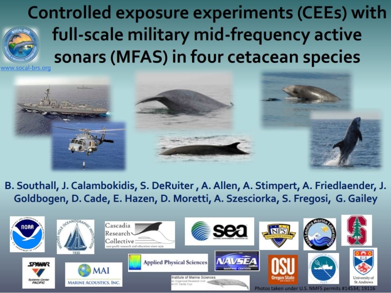
Assess behavioral response of beaked and pilot whales to mid-frequency tactical sonar
Complete
Project Objectives
Assess the abundance, distribution, ecology, and behavior of marine mammals, sea turtles, and seabirds in U.S. Atlantic EEZ
Current
Project Objectives
Utilize newly developed statistical methods from the Atlantic BRS project and apply them to all the satellite-tagged pilot whales from both the Atlantic and Pacific studies.
Complete
Project Objectives
Understand the behavioral response of humpback whales to approaching vessels in the shipping channels at the mouth of the Chesapeake Bay.
Complete
Project Objectives
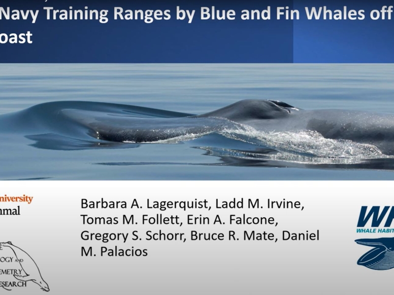
Determine the movement patterns, occurrence, and residence times of blue whales and fin whales within U.S. Navy training and testing areas as well as Biologically Important Areas along the U.S. West Coast
Complete
Project Objectives
Use acoustic tagging technology to provide critical information on spatial and temporal distribution of salmonids to inform salmon management, U.S. Navy activity, and Southern Resident Killer Whale (SRKW) conservation. The study seeks to 1) determine the occurrence and timing of salmonids within the Navy training ranges, 2) describe the influence of environmental covariates on salmonid occurrence; and, 3) describe the occurrence of salmonids in relation to SRKW distribution.
Current
Project Objectives
Assess Gulf Sturgeon distribution and habitat use through a multi-phase biotelemetry approach
Current
Project Objectives
Further our understanding of the Monitoring Questions: 1) What is the occurrence and estimated received levels of MFAS on 'blackfish', humpback, minke, sperm and Blainville's beaked whales within the PMRF instrumented range? and 2) What, if any, are the short term behavioral responses of 'blackfish,' humpback, minke, sperm and Blainville's beaked whales when exposed to MFAS/explosions at different levels/conditions at PMRF?
Current
Project Objectives
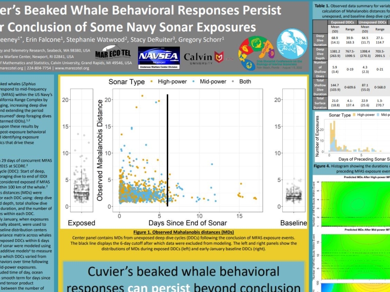
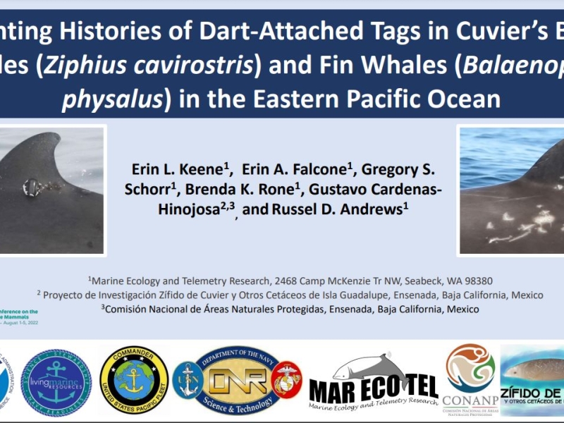
Improve knowledge of baseline population demographics, vital rates, and movement patterns of Cuvier’s beaked whales and fin whales. Examine what, if any, short term behavioral and/or vocal responses occur when exposed to sonar or explosions at different levels and conditions. Determine if exposure to sonar or explosives impact the long term fitness and survival of individuals or the population, species, or stock
Current
Project Objectives
Assess availability bias and habitat associations of endangered Kemp’s ridley and threatened green sea turtles to improve spatial density models
Complete
Project Objectives
Determine the at-sea distribution of endangered Guadalupe fur seals and whether they travel through or utilize the offshore waters of the Southern California Range Complex and Northwest Training and Testing area
Current
Project Objectives
Conduct systematic line transect survey for marine mammals for density estimates; conduct survey to determine ecotype identity of killer whales; analyze existing and newly collected data for seasonal occurrence, abundance, and density of cetacean
Complete
Project Objectives
Investigate potential impacts of naval activities on Hawaiian monk seals
Current
Project Objectives
Monitor species composition and distribution on JSWTR, support M3R species verifications
Complete
Project Objectives
Assess ocurrence and behavior of loggerhead, green, and Kemp's ridley sea turtles in the Hampton Roads region of Chesapeake Bay and coastal Atlantic Ocean
Complete
Project Objectives
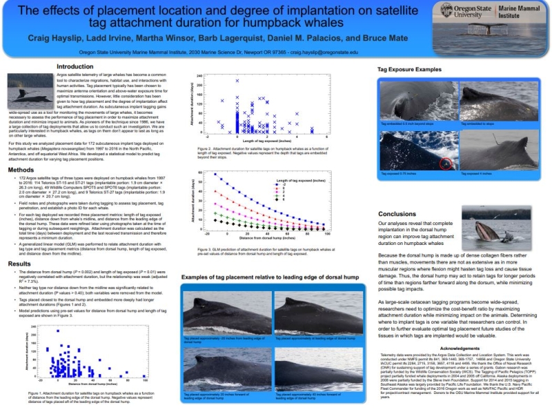
Assess occurrence, habitat use, and baseline behavior of humpback whales in the mid-Atlantic region
Current
Project Objectives
Assess occurrence, habitat use, and baseline behavior of baleen whales in the mid-Atlantic region
Current
Project Objectives
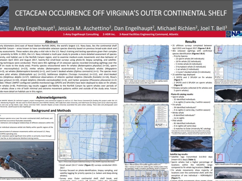
Assess occurrence, habitat use, and baseline behavior of cetaceans in the offshore and continental shelf break region of the VACAPES OPAREA
Current
Project Objectives
This 12‑month integrated pilot project combines three complementary components: (A) shore‑based theodolite monitoring of harbor porpoises, (B) high‑bandwidth passive acoustic monitoring and soundscape characterization, and (C) suction‑cup multi‑sensor tag deployments on Bigg’s (transient) killer whales. Together, these data streams will quantify occurrence, movement, diving, and behavioral context for these two key species in relation to the local soundscape—including operational signals near the Dabob Bay Range Complex (DBRC) and the Bangor Trident Base. Results can provide an empirical foundation and inform the study design of future cetacean behavioral response studies (BRS) in Hood Canal.
Complete
Project Objectives
Assess behavior of right whales in coastal waters of the Southeast calving grounds, including rates of travel of individuals, dive behavior, and rates of sound production
Current
Project Objectives
Assess occurrence, habitat use, and behavior of North Atlantic right whales in the mid-Atlantic region
Complete
Project Objectives
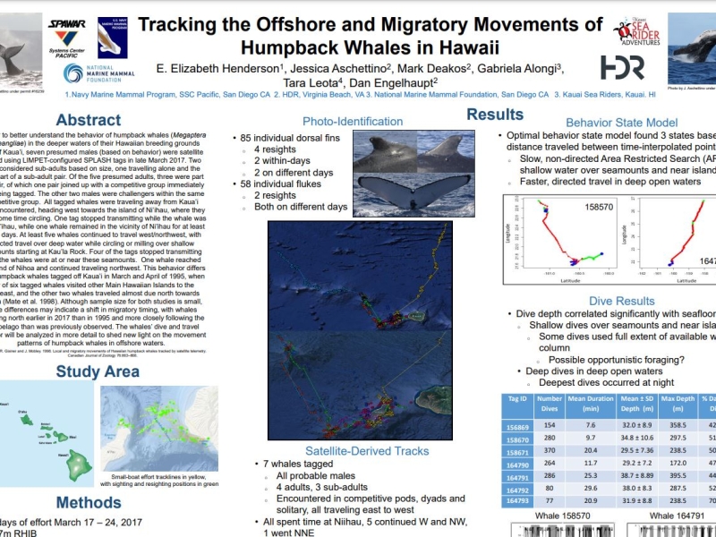
Determine the occurrence, movement patterns, and residency patterns of multiple humpback whale Distinct Population Segments within Pacific Ocean Navy Range Complexes
Complete
Project Objectives
Compile green sturgeon tag and receiver data and analyze historical data for occurrence, distribution, and seasonality in Puget Sound and the Straits of Juan de Fuca
Complete
Project Objectives
Establish behavioral baseline and foraging ecology. Assess behavioral response to acoustic stimuli and Navy training activities
Complete
Project Objectives
1) Identify and classify Southern Resident killer whale (SRKW) detections from acoustic recorders and satellite tag tracking; 2) Develop a model to estimate the seasonal and annual occurrence patterns of southern resident killer whales relative to offshore Navy training ranges. 3) Characterize occurrence of anthropogenic sounds in potential SRKW habitat. 4) Develop state space habitat model for SRKW prey, based on fall Chinook salmon tagged released from California to British Columbia between 1977 and 1990 to estimate seasonal distribution along the west coast.
Current
Project Objectives
Identify species of beaked whales, odontocetes, and baleen whales that occur in the surveyed areas; Monitor marine mammal and sea turtle presence, distribution, and diversity in offshore waters; Develop a better understanding of marine mammal distribution, movement patterns, habitat use, population structure, and abundance; Develop reference library of visually-validated acoustic recordings of marine mammals.
Current
Project Objectives
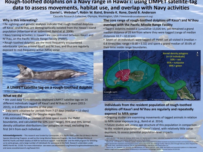
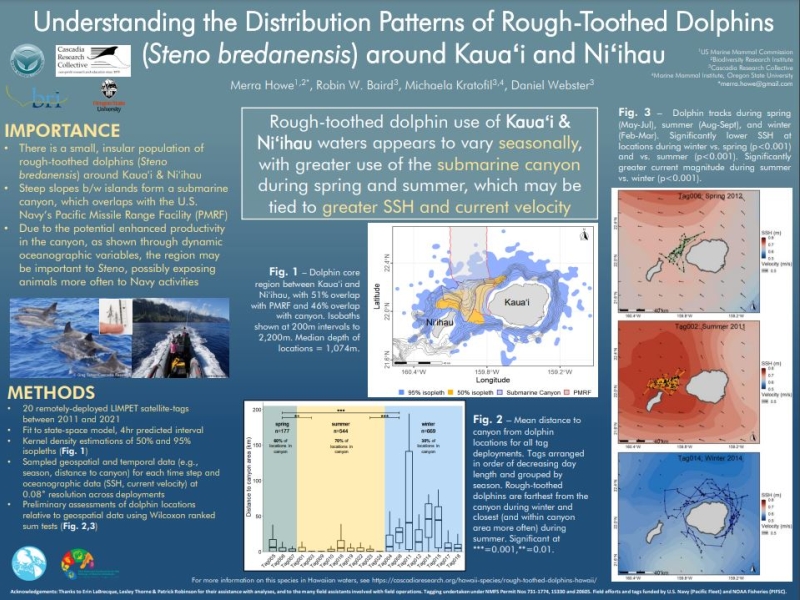
Determine feasibility and efficacy of deploying high resolution multi-sensor tags on rough-toothed dolphins at PMRF and determine how collected data can be used to move toward a better understanding of the effects of Navy activities, ultimately leading to PCoD modelling.
Complete
Project Objectives
Document habitat use, haul-out patterns, and baseline behavior of seals
Complete
Project Objectives
Document habitat use, movement and haul-out patterns of seals in the Hampton Roads region of Chesapeake Bay and coastal Atlantic Ocean
Current
Project Objectives
1) Determine the occurrence of bull trout within and near the boundaries of the NWTT; 2) Determine the spatiotemporal occurrence of killer whale and baleen whale in the NWTT; 3) Characterize the occurrence of endangered fish species within the NWTT
Complete
Project Objectives
To determine the abundance and habitat use of California sea lions that haul out at Navy facilities and forage in testing and training areas
Complete
Project Objectives
Develop a better understanding of sea turtle distribution and habitat use in the Mariana Islands, particularly in relation to locations used by the Navy for underwater detonation training
Complete
Project Objectives
Identify species of beaked whales, odontocetes, and baleen whales that occur in the Mariana Islands; Monitor marine mammal and sea turtle presence, distribution, and diversity in nearshore waters during key seasons (summer and winter); Develop a better understanding of marine mammal distribution, movement patterns, habitat use, population structure, and abundance; Develop reference library of visually-validated acoustic recordings of marine mammals.
Current
Project Objectives
To use a combination of pop-up satellite technology and salmon genetics to provide critical information on Chinook salmon spatial and temporal distribution in the Gulf of Alaska and along the Washington coast to inform salmon management and U.S. Navy training activities. The study seeks to 1) determine the occurrence, timing, and specific run of Chinook salmon through genetics within the Navy training areas; 2) describe the influence of environmental covariates on Chinook salmon occurrence; and 3) improve the understanding of run-specific timing and geographical occurrence of Chinook salmon as the prey of Southern Resident killer whales in Washington.
Current
Project Objectives
(1) define the spatial movement and habitat use patterns of species that are exposed to mid-frequency active (MFA) sonar (2) determine how these patterns influence exposure and potential responses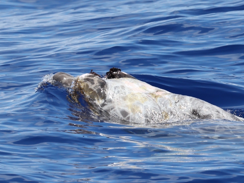
Kaua‘i field project - August 2026
August 25, 2026
Researchers from Cascadia Research Collective are conducting a 9-day field session off Kaua'i to deploy LIMPET satellite tags on odontocete cetaceans prior to a Submarine Command Course (SCC) to be…
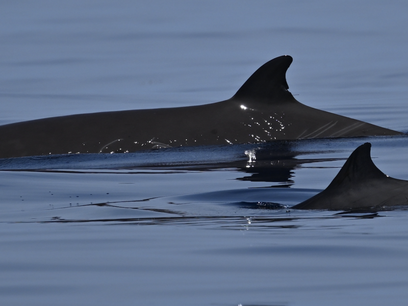
Another CEE Trial – and Gervais’ beaked whales!
August 10, 2026
A second controlled exposure experiment trial with simulated Continuously Active Sonar (CAS) was conducted on August 1. In addition to the usual goose-beaked whales, we also had a sighting of less…
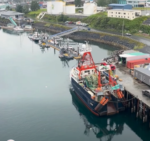
Killer Whale Ecotype Study (KWEST) kicks off
July 27, 2026
Research scientists from the University of Washington and NOAA recently departed from Kodiak, AK aboard the R/V Aquila for a 2-month research cruise focused on distinct groups of killer whales, or…
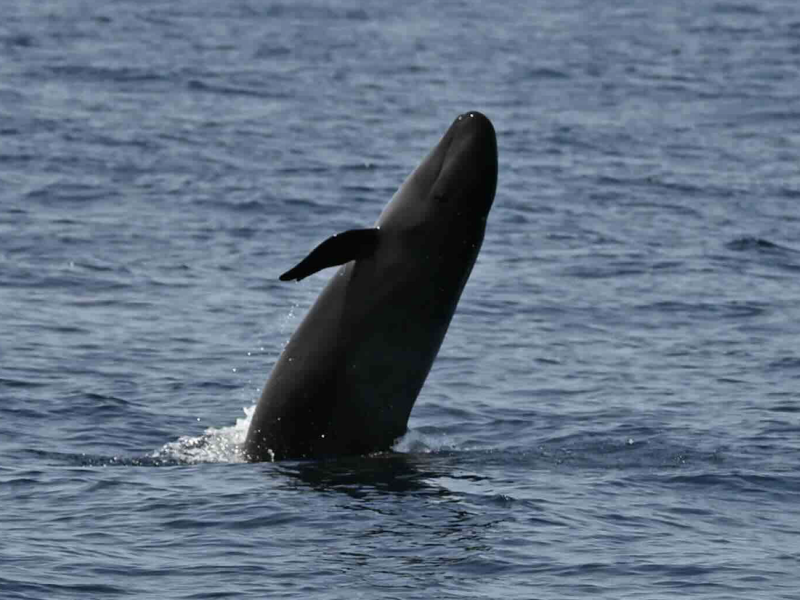
First CEE Trial of 2026 – and False Killer Whales
July 23, 2026
The Atlantic BRS team had an extremely productive day on Friday, July 17th with tags deployed on both false killer whales and goose-beaked whales, as well as a successful controlled exposure…
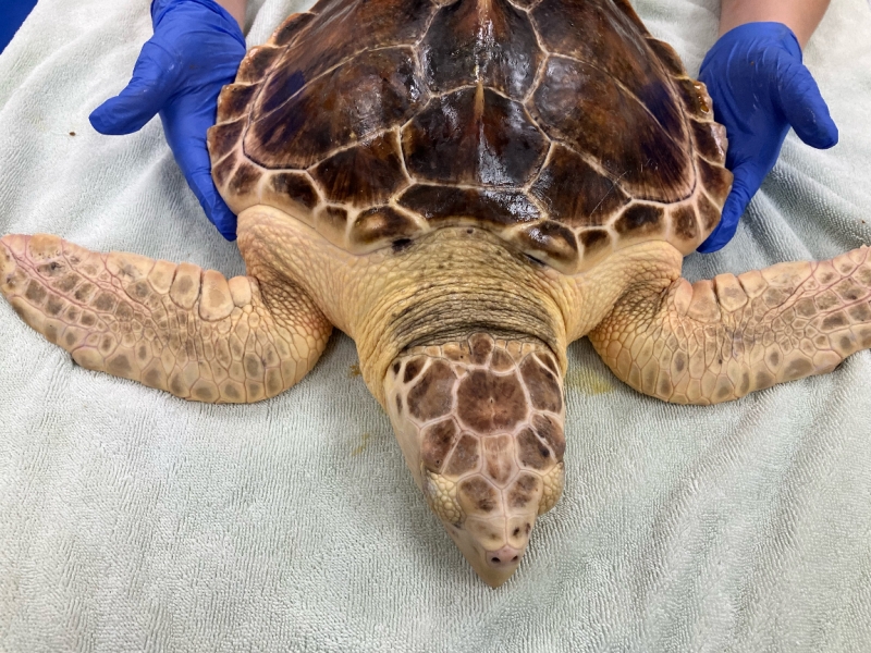
Kemp’s ridley / Loggerhead Hybrid Turtle Tagged at Jekyll Island
June 15, 2026
Researchers were surprised by an unusual turtle that stranded in Georgia-- a Kemp’s ridley / Loggerhead Hybrid Turtle, and were able to tag the animal for release.
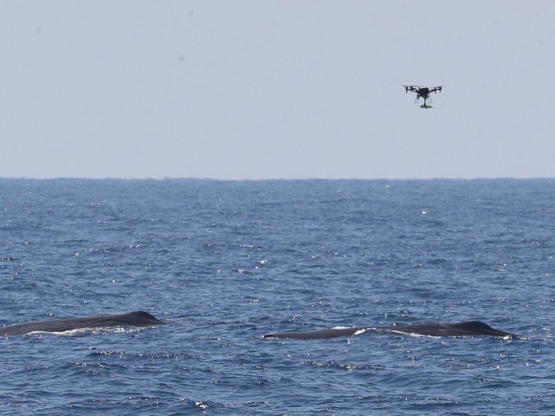
A Macrocephalus Mother's Day Tradition
May 27, 2026
HDR-lead team encountered a group of mainly female sperm whales with calves on Mother's Day for the 2nd year in a row, and successfully deployed a tag from a drone. We believe it's the first CATS tag…
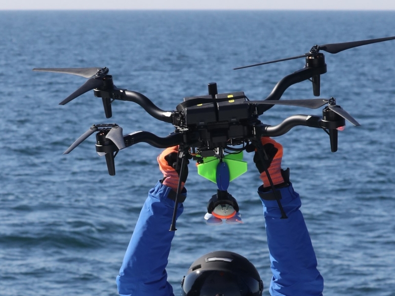
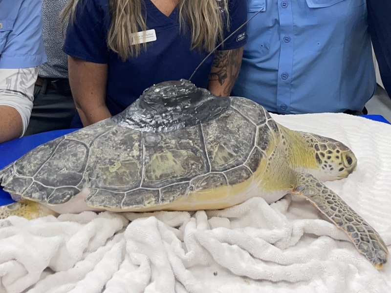
First Tagged Sea Turtle Released from Jekyll Island, Georgia
October 17, 2025
Collaborators at the Jekyll Island Authority in Georgia have released the first satellite-tagged green turtle in Georgia waters under the Navy’s “Green and Kemp's Ridley Turtle Tagging for…
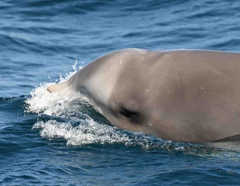
Controlled Exposure Experiment Trial with Simulated CAS Signals
October 1, 2025
On Friday, September 19th, the project team led by Duke University and Southall Environmental Associates conducted a Controlled Exposure Experiment (CEE) trial with goose-beaked whales Ziphius…
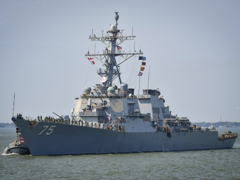
Atlantic BRS - successful CEE trial with the USS Donald Cook
July 22, 2025
The Atlantic BRS team just completed a successful controlled exposure experiment with the Arleigh Burke-class guided-missile destroyer USS Donald Cook (DDG 75) involving eight satellite-tagged beaked…
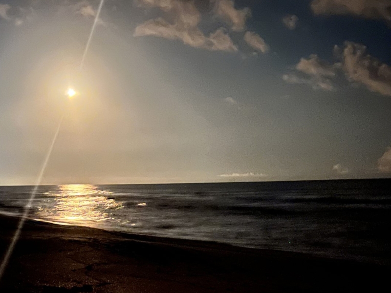
Green turtles are back on the Space Coast
July 21, 2025
A field team led by co-Principle Investigator Dr. Kate Mansfield of the Marine Turtle Research Group at the University of Central Florida kicked off the second year of tagging for our “Kemp’s Ridley…
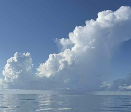
Atlantic BRS - field work update
July 16, 2025
You never know what you will see offshore, and this weekend was no exception.
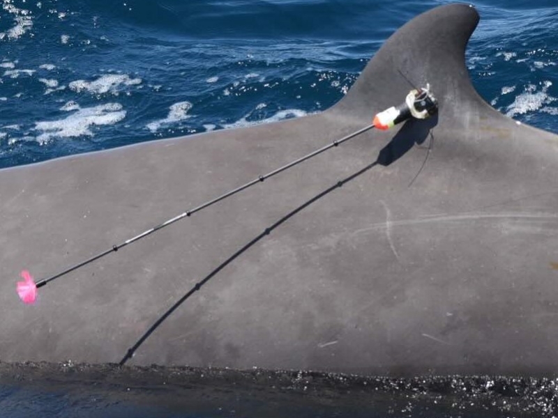
Atlantic BRS 2025 - Old Friends & Baby Beaked Whales
June 26, 2025
Field work recently kicked off for the Atlantic BRS project field season and we're happy to say that things appear much more "normal" compared to 2024 when Ziphius were relatively scarce at the…
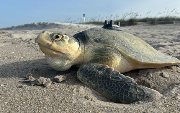
Kemp's on the move!
May 19, 2025
Five Kemp’s ridley turtles satellite tagged on the east coast of Florida have moved out of Florida waters.
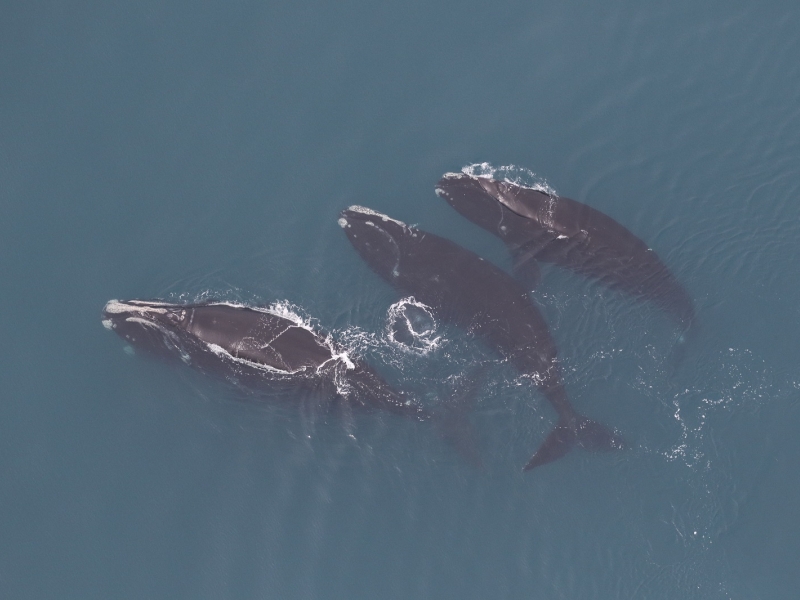
2024-2025 Large Whale Season Summary
March 24, 2025
We have two separate efforts focusing on cetaceans off the coast of Virginia. The first is our Offshore (Outer Continental Shelf) Cetacean Study, which focuses primarily on deep diving odontocetes…
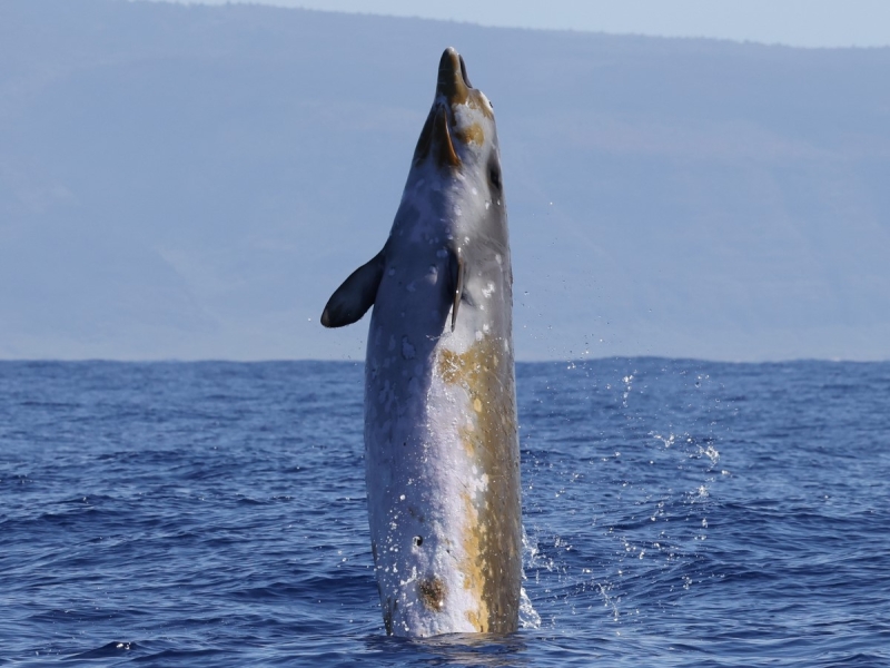
Kaua'i Field Work Updates
February 20, 2025
Scientists from Cascadia Research Collective recently completed a ~9-day field project off Kaua’i that started on February 9th. This project is timed to occur prior to a Submarine Command Course (SCC)…
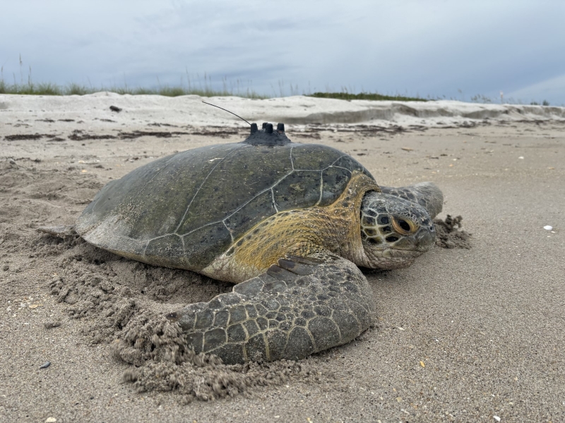
Males have joined the turtle tagging party
July 15, 2024
Researchers from Inwater Research Group (IRG), supported by Dr. Kate Mansfield of the UCF Marine Turtle Research Group and Andrew DiMatteo of CheloniData LLC, have deployed a satellite-linked data…
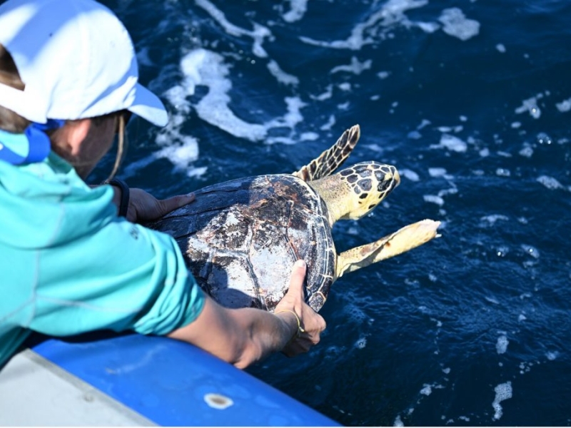
First Satellite Tag Deployments for Atlantic BRS 2024
July 8, 2024
In June 2024, a Duke University team initiated the Atlantic Behavioral Response Study (BRS) by deploying satellite-linked dive recorders on goose-beaked whales (Cuvier's beaked whales) off the coast…
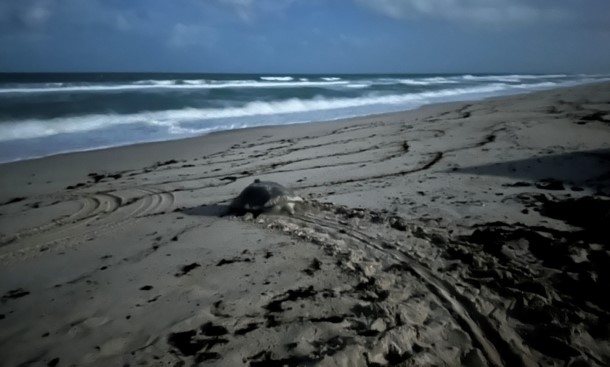
Back in the turtle tagging business
June 28, 2024
Researchers at the University of Central Florida (UCF), led by Dr. Kate Mansfield and supported by the UCF Marine Turtle Research Group and Andrew DiMatteo of CheloniData LLC, deployed five…
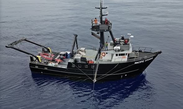
Mesoplodon mysterioso
June 13, 2024
We are thrilled to be part of the "Mystery Mesoplodon Expedition" off the west coast of Baja California searching for an elusive new species of beaked whale. Read about the initial discovery and stay…
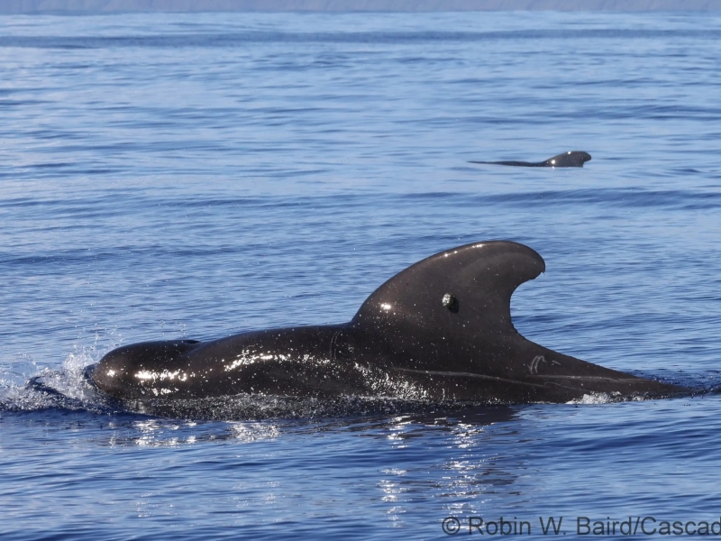
Kauai' Field Work Updates
February 16, 2024
Scientists from Cascadia Research Collective are leading a ~9-day field project off Kaua’i that started on February 11th.
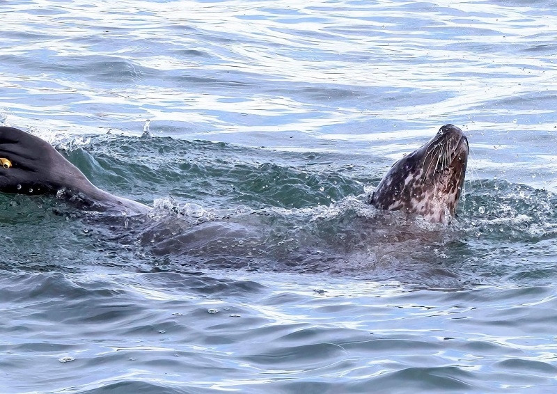
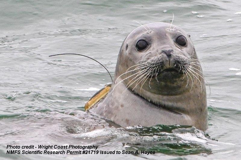
Seal Tagged in 2022 is Back Again!
February 14, 2024
On 10 February 2024, a local wildlife enthusiast, Caroline Prevost, was out on the Chesapeake Bay when she observed some harbor seals enjoying time in the water near island 4 of the Chesapeake Bay…
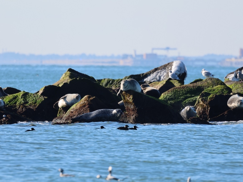
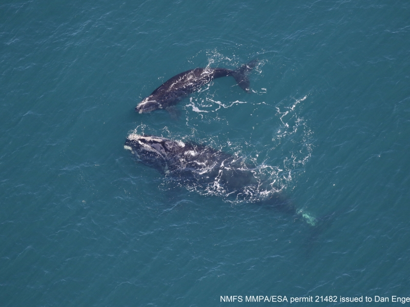
Coming full circle – right whale mom returns with calf
March 15, 2023
Previously CATS tagged Right whale "Smoke" is sighted again in VA with a calf.
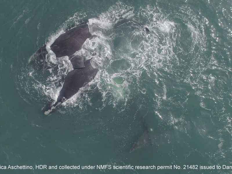
Right Whale Party in the Mid-Atlantic
February 4, 2023
A Surface Active Group of North Atlantic right whales off the coast of Virginia.
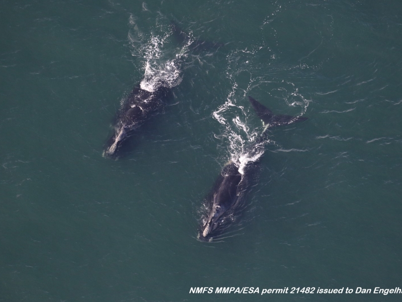
Right whales are on the move!
November 23, 2022
Two female right whales were sighted off Virginia during their southbound migration.
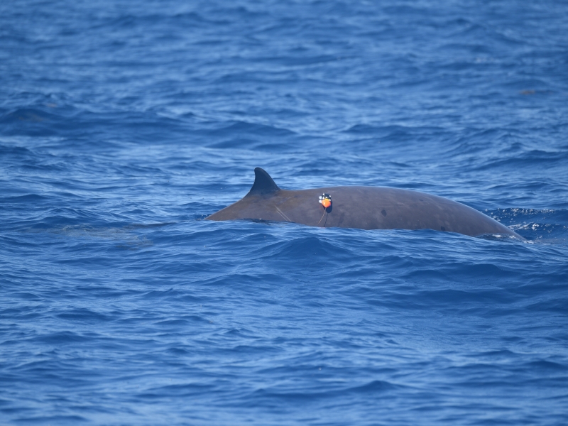
Atlantic BRS – 2022 CEE with the USS Farragut
August 26, 2022
A controlled exposure success story using a Navy ship.
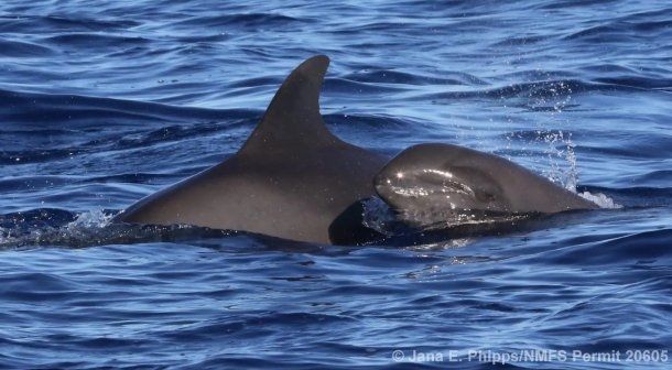
August 2022 Kaua‘i Field Project
August 18, 2022
Cascadia Research Collective began an 8-10 day field project off Kaua’i starting on August 16th. This project is timed to occur prior to a Submarine Command Course (SCC). Their primary goal is to…
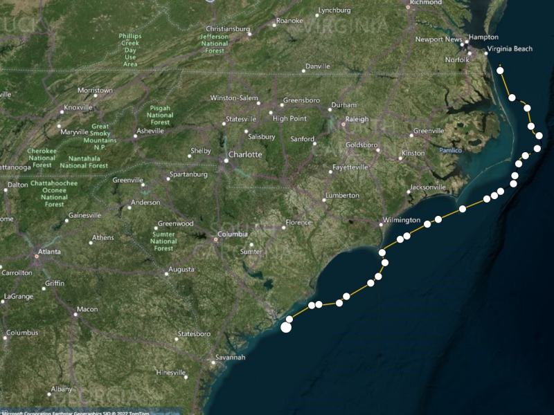
NARW tagged off VA Beach!
March 2, 2022
A yearling right whale was tagged off Virginia.
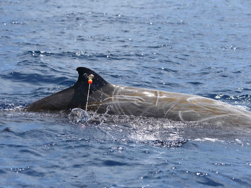
Atlantic Behavioral Response Study kicks off 2021 field season
July 13, 2021
The Atlantic Behavioral Response Study kicked off the 2021 field season last week by deploying the first round of satellite-linked telemetry tags on Cuvier's beaked whales.
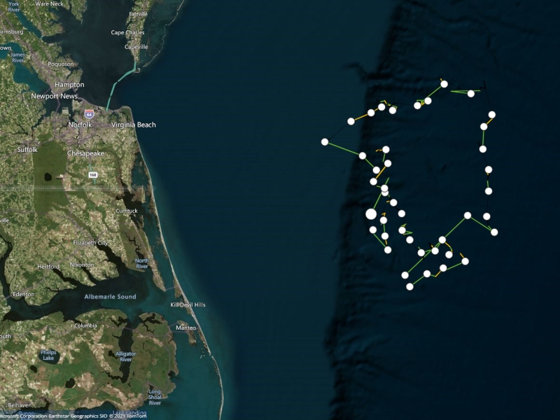
Blue whale tagged off the coast of Virginia
April 26, 2021
Details on the first blue whale tagged in the region.
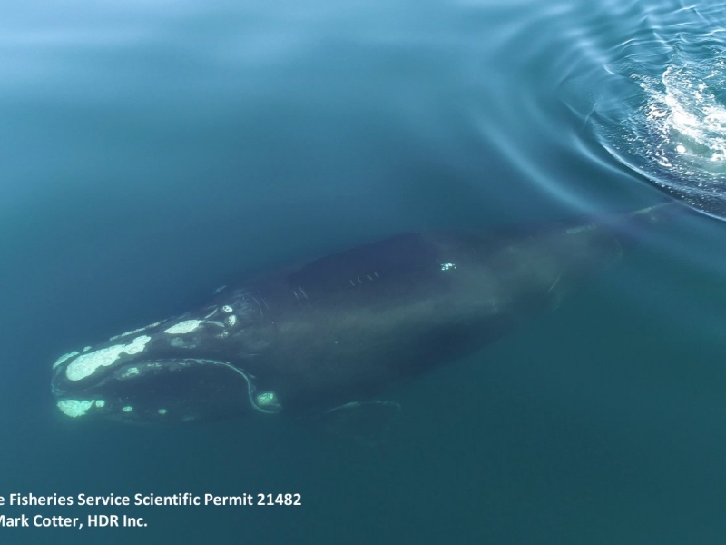
Tracking an endangered North Atlantic right whale
March 15, 2021
A yearling right whale was tagged off the coast of VA and tracked for 12 days.
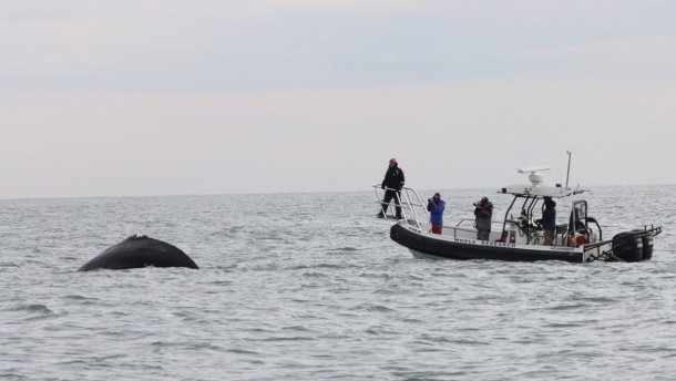
Entangled humpback whale
January 8, 2021
Our team assisted with the disentanglement efforts of a young humpback whale.
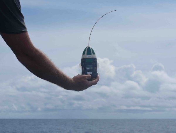
Atlantic BRS - Multi-scale CEE Success!
August 15, 2019
The first CEE while two different tag types were deployed.
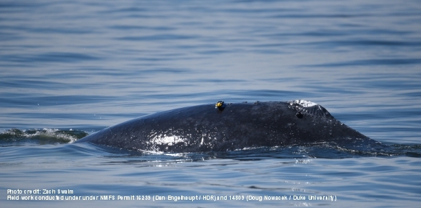
One whale tagged twice.
March 8, 2019
D-tag and limpet tag on a humpback whale.
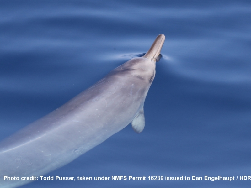
Sowerby's beaked whale tagged offshore of Virginia
September 12, 2018
A rarely seen beaked whale was tracked offshore.
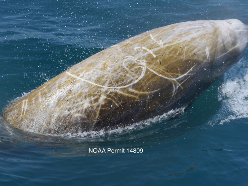
Atlantic BRS 2018 Field Work is Underway
May 18, 2018
The 2nd year of Atlantic BRS has begun.
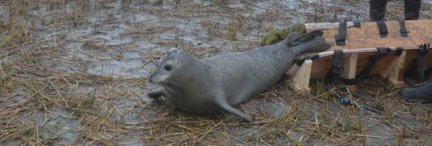
Seal Tagging Team Win!
February 6, 2018
Successful seal tag deployment on the Eastern Shore of VA.
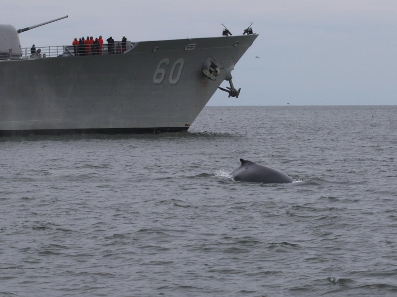
Repeat tagging customers to humpback monitoring project
January 30, 2018
Some interesting notes on site fidelity in Humpack whales.
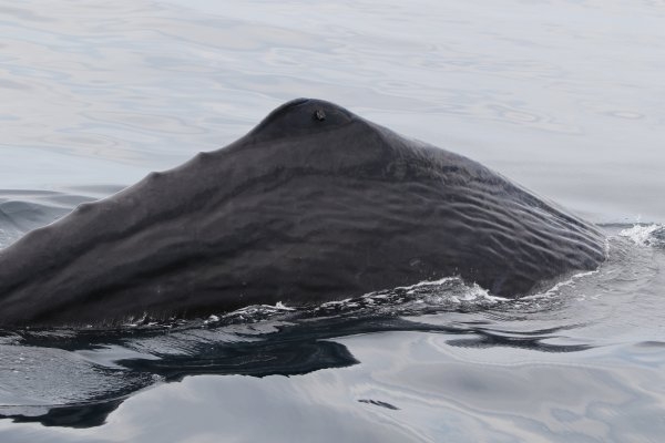
Sperm whales tagged off Virginia Beach
August 25, 2017
Several groups of sperm whales were sighted offshore of VA.
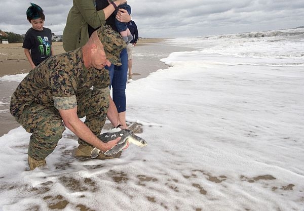
"Purple Heart" sea turtle released back into the ocean
June 12, 2017
Rescued sea turtle is tagged and released by a retired Marine.
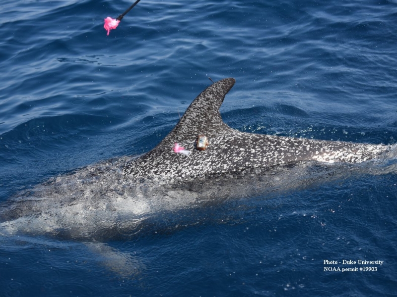
Bonus tagging in JAX
June 15, 2016
Odontocete tagging in Florida.
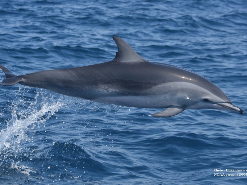
Banner day tagging odontocetes at Hatteras!
June 1, 2016
A busy field day in NC.
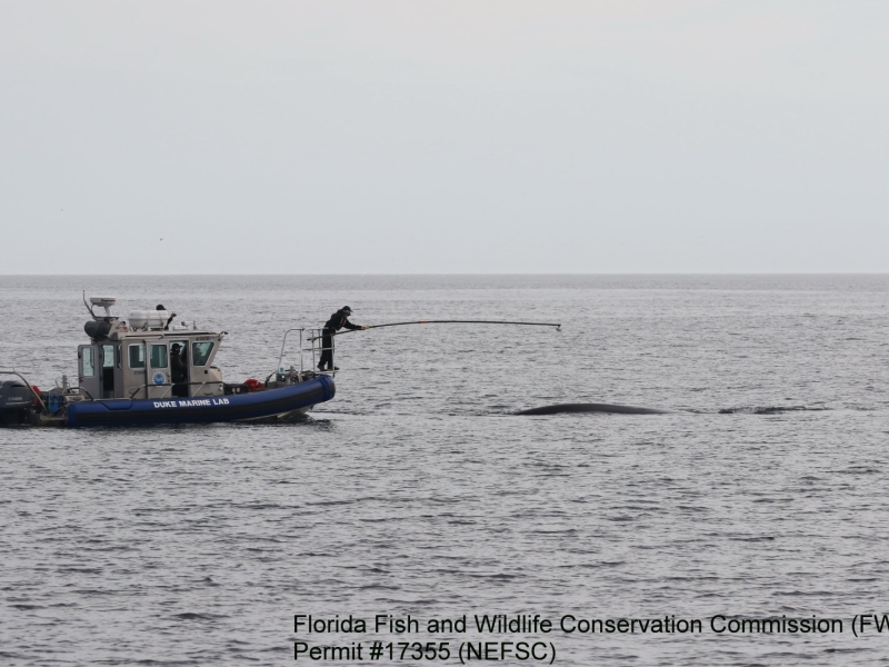
Tagging North Atlantic Right Whales
May 9, 2016
Southeast US tagging project has successful season.
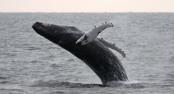
Tagging Atlantic Humpbacks
January 8, 2016
Year two of our Chesapeake Bay humpback whale project has begun!
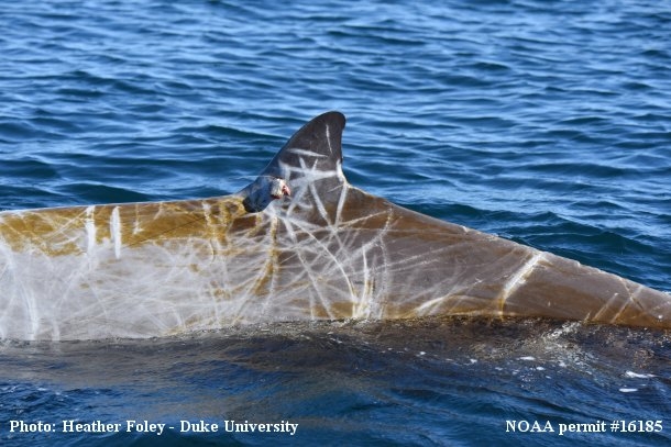
Hatteras tagging wraps up for 2015
November 10, 2015
The finale of a successful field season.
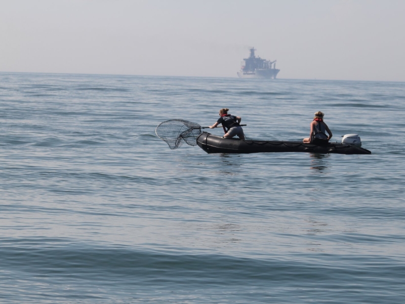
Turtle Tagging Season Has Begun!
May 18, 2015
Tagging loggerhead and Kemp's ridley sea turtles off Virginia.
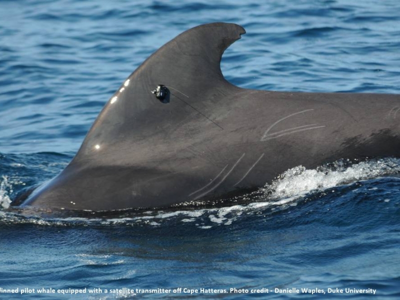
Tagging Deep Diving Odontocetes Off Cape Hatteras - Part 3
September 26, 2014
Details on the 3rd field session for the year.
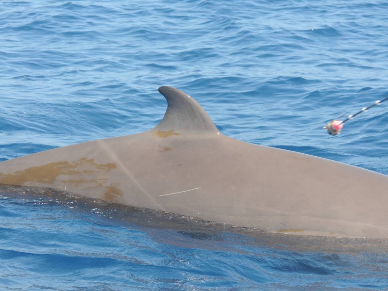
Tagging Whales Off Cape Hatteras
May 21, 2014
Learning about the movements of odontocetes.
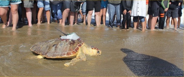
Sea Turtle Rehabilitation and Release
November 26, 2013
Tagging rescued sea turtles.
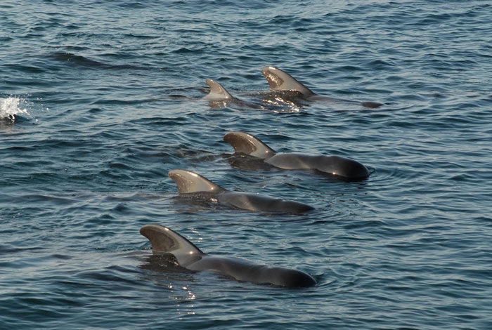
Cape Hatteras Field Work Update
October 28, 2013
Calm days at sea off NC.
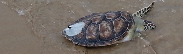
Atlantic sea turtle tagging project is underway!
July 17, 2013
The start of a new turtle project.
Evidence of pier fidelity in hooked and released loggerhead and Kemp's ridley sea turtles using acoustic and satellite telemetry.
3rd Southeast Regional Sea Turtle Meeting (SERSTM) .
More details
Collapse details
Date Published:
Ocean:Species:
- January 27, 2026
Behavior and Distribution Bull Trout off Washington
U.S. Navy Integrated Comprehensive Monitoring Program.
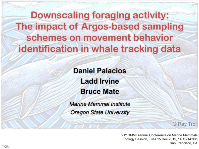
19th Biennial Conference on the Biology of Marine Mammals .
More details
Collapse details
Date Published:
Filesize:
- November 27, 2011
The Integrated Comprehensive Monitoring Program (ICMP) provides an overarching framework for coordination of U.S. Navy marine species monitoring. It is intended for use as a planning tool to focus Navy monitoring priorities pursuant to ESA and MMPA requirements and as an adaptive management tool to analyze and refine monitoring and mitigation techniques over time. It has been developed in direct response to Navy Range permitting requirements established in the various MMPA Final Rules, ESA consultations, and other applicable regulations. In early 2011 the Navy established a Scientific Advisory Group (SAG) consisting of experts in marine mammal ecology, passive acoustic monitoring, and cetacean behavior. The Navy convened the SAG with the initial task of evaluating current monitoring approaches under the ICMP and existing Letters of Authorization and developing objective scientific recommendations that will serve as the basis for a Strategic Plan for Navy monitoring. The Strategic Plan will be integrated as a primary component of the ICMP and provide a comprehensive 3-5 year “vision” for Navy monitoring across geographic regions - serving as guidance for determining how to most efficiently and effectively invest the U.S. Fleet marine species monitoring budget to address ICMP objectives and satisfy Marine Mammal Protection Act Letter of Authorization regulatory requirements for Fleet testing and training activities.
- 169.53 KB
U.S. Navy Marine Mammal Compliance and Mitigation Program in the Atlantic: A review.
21st Biennial Conference on the Biology of Marine Mammals .
More details
Collapse details
Date Published:
Filesize:
- December 13, 2015
The U.S. Navy's Atlantic Fleet conducts training and testing activities within the Northwest Atlantic Ocean and Gulf of Mexico, including the use of active sonar and explosives. While training and testing activities have the potential to impact the environment, the Navy employs every means available, without jeopardizing the safety of Sailors or impacting military readiness, to mitigate the potential environmental effects of these activities. Prior to training and testing activities, the Navy consults extensively with environmental regulators to determine appropriate mitigations to protect marine species, particularly marine mammals. Additionally, in order to evaluate the impacts of Navy activities on marine mammals and other protected species, the Navy has implemented a monitoring program to collect data on baseline animal presence, as well as exposure and response to Navy training and testing activities. Passive acoustic monitoring remains a cornerstone of addressing revised long term objectives of the monitoring program, and continues to provide key data on marine mammal presence and behavior. Future work will focus on species classification and animal behavior before, during, and after exposure to potential stressors. This presentation will provide an overview of Navy environmental compliance in the Atlantic, including monitoring efforts. This presentation will also discuss the tools and processes that Navy uses to assess the potential impacts of activities, how mitigation is used to reduce those impacts, and protective measures such as the restrictions employed in the North Atlantic right whale critical habitat areas. The Navy remains committed to marine stewardship and responsible management of the potential impacts of training and testing activities on protected species.
- 91.18 KB
U.S. environmental compliance and conservation efforts for sea turtles in the Atlantic and Gulf of Mexico.
NOAA technical memorandum NMFS PIFSC. 2013.
38-39
More details
Collapse details
Date Published:
Filesize:
- July 2, 2013
Environmental stewardship is an integral part of the Navy's mission. It protects and preserves the capabilities of training areas, ensures operational flexibility, and sustains the resources and public support needed to carry out the Navy's mission. The Navy is responsible for compliance with a suite of environmental and natural resources laws and regulations that apply to the marine environment, and in particular, to sea turtles. To comply with these mandates, the Navy works closely with regulatory agencies and must be able to properly evaluate the impacts of at-sea training activities on protected species. In order to institute efforts to minimize these impacts there must be: I) the best available data on the density and distribution of the species in question; 2) the criteria necessary to assess impacts; and 3) the creation of the practical mitigation measures. To meet these objectives, the Navy developed the Navy Marine Species Density Database (NMSDD) which documents density estimates for all sea turtle populations where the Navy primarily trains in the Atlantic Ocean and Gulf of Mexico. The Navy also established an initial set of quantitative criteria for assessing acoustic impact to sea turtles from sonar and explosives. These data are utilized in regulatory compliance documents to support quantitative modeling and qualitative assessments of the potential impacts of a variety of Navy stressors on sea turtles and their habitats, including but not limited to the use of sonar, explosives, and military expended materials. Additionally, the Navy employs mitigation measures both at-sea and on Navy installations to minimize the impacts of Navy activities on sea turtles and to promote conservation of their populations. Some of these measures include monitoring sea turtle nests on Navy beaches during the nesting season, having trained lookouts to observe mitigation zones during at-sea training activities to minimize potential effects to sea turtles, and conducting or funding sea turtle research to reduce knowledge gaps. The Navy continues to be a leader in environmental stewardship and utilize the best technology and techniques to improve our compliance and conservation efforts with respect to sea turtle populations. However, deficiencies in the amount or quality of data available, as well as access to research, can significantly limit the Navy's ability to assess and mitigate impacts. As a result, the Navy plans to improve partnerships with international, federal, state, and local agencies; public and private organizations; and academic institutions by engaging stakeholders to maximize our effectiveness in addressing environmental issues.
- 762.70 KB
Biologically Important Areas II for cetaceans within U.S. and adjacent waters - West Coast Region.
Frontiers in Marine Science. 2024.
11:1283231.
More details
Collapse details
Date Published:
Publication:Ocean:Species:
- March 11, 2024
Here we update U.S. West Coast Biologically Important Areas (BIAs) that were published in 2015 using new data and approaches. Additionally, BIAs were delineated for two species that were not delineated in the 2015 BIAs: fin whales and Southern Resident killer whales (SRKW). While harbor porpoise BIAs remained the same, substantial changes were made for other species including identifying both larger overall areas (parent BIAs) and smaller core areas (child BIAs). For blue, fin, and humpback whales we identified, delineated, and scored BIAs using the overlap between the distribution and relative density from three data sources, leveraging the strengths and weaknesses of these approaches: 1) habitat density models based on Southwest Fisheries Science Center (SWFSC) line-transect data from systematic ship surveys conducted through 2018, 2) satellite tag data from deployments conducted by three research groups, and 3) sightings of feeding behavior from non-systematic effort mostly associated with small-boat surveys for photo-identification conducted by Cascadia Research Collective. While the previous BIAs were based solely on a more subjective assignment from only the small boat sightings, here we incorporate the other two data sources and use a more rigorous, quantitative approach to identify higher density areas and integrate the data types. This resulted in larger, better-supported, objective BIAs compared to the previous effort. Our methods are also more consistent with the delineation of BIAs in other regions. For SRKWs, the parent BIA was based on a modification of the Critical Habitat boundaries defined by the National Oceanographic and Atmospheric Administration (NOAA) and the Department of Fisheries and Oceans (DFO) Canada; a core BIA highlighting areas of intensified use was identified using both NOAA’s Critical Habitat and kernel density analyses of satellite tag data. Gray whale BIAs were re-evaluated for the migratory corridor of Eastern North Pacific gray whales, for Pacific Coast Feeding Group feeding areas, and for gray whales that feed regularly in Puget Sound.
A hand-held tool for rapid assessment of underwater sound to inform decision making.
21st Biennial Conference on the Biology of Marine Mammals .
More details
Collapse details
Date Published:
Filesize:
- December 13, 2015
Measurements of underwater noise from pile driving have been collected in San Diego Bay during a marine construction project, to inform placement of marine mammal observers, and adhere to Incidental Harassment Authorization (IHA) requirements. This presentation will focus on a subset of these measurements made with a hand-held device, or Underwater Sound Level Meter (USLM). The USLM employs an intuitive operating menu, requires no specialized training, and rapidly delivers fully calibrated results expressed in the relevant metric, such as peak level, rms level and sound exposure level. Several examples will be discussed involving the documentation of isopleths associated with the 190 dB and 180 dB isopleths (rms level, dB re 1 µPa) that define Level A injury thresholds for pinnipeds and cetaceans, respectively. One represents a unique set of measurements made during which the USLM documented the evolution of the underwater sound field from impact pile driving versus range every approximately 5 m. This made possible by recording from a small vessel that slowly opened in range from the pile source (the USLM also records its own position via GPS. ) The results of such fine-scale range sampling are also compared with modeling of transmission loss with range from the pile. Stakeholders in both industry and government share the same goal of rapid, calibrated measurements of underwater noise to protect marine life and comply with statuary environmental regulations. The USLM is a time and labor saving device that meets this goal.
- 91.71 KB
More details
Collapse details
Date Published:
Filesize:
- January 1, 2012
The U. S. Navy (Navy) has developed this Mariana Islands Range Complex (MIRC) Monitoring Plan to provide marine mammal and sea turtle monitoring as required under the Marine Mammal Protection Act (MMPA) of 1972 and the Endangered Species Act (ESA) of 1973. In order to issue an Incidental Take Authorization (ITA) for an activity, Section 101(a)(5)(a) of the MMPA states that National Marine Fisheries Service (NMFS) must set forth “requirements pertaining to the monitoring and reporting of such taking.” The MMPA implementing regulations in 50 CFR Section 216.104 (a)(13) note that requests for Letters of Authorization (LOAs) must include the suggested means of accomplishing the necessary monitoring and reporting that will result in increased knowledge of the species and of the level of taking or effects to populations of marine mammals that are expected to be present.
- 510.53 KB
Global distribution of fin whales Balaenoptera physalus in the post-whaling era (1980–2012).
Mammal Review. 2015.
45:197-214
More details
Collapse details
Date Published:
Publication:Species:
- September 16, 2015
The global distribution of fin whales Balaenoptera physalus is not fully understood. Existing maps can be divided into two conflicting categories: one showing a continuous global distribution and another showing an equatorial hiatus (gap in the global distribution) between approximately 20°N and 20°S. Questions also remain about the seasonal distribution of fin whales. To explore the suggested equatorial hiatus and seasonal distribution patterns, we synthesised information on fin whale distribution in the post-whaling era (1980–2012) from published literature, publicly available reports and studies conducted by various organisations. We created four seasonally stratified maps showing line-transect density estimates, line-transect survey effort, acoustic detections, and sightings. An equatorial hiatus in the global distribution of fin whales during the postwhaling era is supported by numerous line-transect surveys and by the rarity of equatorial acoustic detections and sightings, and corroborated by whaling era reports, morphological analyses, and genetic analyses. Our synthesis of post-whaling era data is consistent with results from other studies indicating that fin whales are more abundant at higher latitudes during warmer months and more abundant at lower latitudes (although these latitudes are still greater than 20°) during colder months. However, our synthesis and results from other studies also indicate that some fin whales in both hemispheres remain in higher latitudes (50°–60° north or south) during colder months and in lower latitudes (to approximately 20°–30° north or south) during warmer months, indicating that seasonal fin whale movements differ from the seasonal migrations of blue whales Balaenoptera musculus and humpback whales Megaptera novaeangliae. Our maps of global fin whale distribution provide a comprehensive picture of current knowledge and highlight important geographical and temporal data gaps. Surveys should be conducted within the identified data gaps in order to increase fine-scale spatial and temporal knowledge of distribution patterns, improve fin whale taxonomy, and identify areas of elevated fin whale densities that may require management of threats, such as ship strikes.
Modeling of zones of influence and ambient noise metrics to inform decision making.
21st Biennial Conference on the Biology of Marine Mammals .
More details
Collapse details
Date Published:
Filesize:
- December 13, 2015
Measurements of underwater noise from pile driving were collected in San Diego Bay during a marine construction project to inform placement of marine mammal observers, and adhere to Incidental Harassment Authorization (IHA) requirements. This work presents the modeling of Zones of Influence (ZOIs) for pile driving noise as well as results from ambient noise monitoring. Results from real-time monitoring showed good agreement with the modeling isopleths associated with the 190 dB and 180 dB isopleths (rms level, dB re 1 µPa) that define Level A injury thresholds for pinnipeds and cetaceans, respectively. Ambient noise measurements were also collected in the bay; we evaluate the L10, L50 and L90 exceedance levels (where Lx means these values were exceeded x% of the time) from a regulatory standpoint.
- 91.82 KB
Oral Presentation, Effects of Sound on Marine Mammals, Beaufort, North Carolina, 15-18 March 2022 .
More details
Collapse details
Date Published:
- March 15, 2022
More details
Collapse details
Date Published:
Filesize:
- January 2, 2025
For this project, time-lapse trail cameras were placed at two survey areas in southeastern Virginia in order to monitor all of the known haul-out sites in the region. Wildlife “trail” cameras are cost effective tools for collecting large amounts of data while limiting the impact to the animals as compared to traditional visual surveys (Koivuniemi et al., 2016; Wearn & GloverKapfer, 2019). Trail cameras are especially effective for monitoring wildlife in remote locations and sampling multiple sites for extended periods of time. The use of these cameras offer the ability to monitor haul-out sites in adverse marine and weather conditions with relatively low personnel demands. Objectives for this study are to: 1) improve the understanding of local haul-out patterns; 2) monitor seasonal patterns and the numbers of seals hauled out; 3) investigate any haul-out patterns in relation to environmental factors; and 4) investigate differences between vessel and drone-based surveys and time-lapse camera data collection.
- 2,162.44 KB
More details
Collapse details
Date Published:
Filesize:
- April 1, 2013
A working group of experts (i.e., biologists, acousticians, and other researchers with extensive experience working in the Hawaii Range Complex [HRC]) was convened in San Diego, California, for an HRC Data Analysis Planning Meeting on 10 and 11 September 2012. The purpose of the meeting was to assess how existing HRC monitoring data can be used to support the United States (U.S.) Pacific Fleet’s regulatory requirements to determine the: 1) presence/absence, abundance, and density of marine mammals and sea turtles in the HRC; and 2) behavioral responses of marine mammals and sea turtles to U.S. Navy training exercises, including mid-frequency active sonar and underwater detonations.
- 499.18 KB
Cue rate and track kinematics of calling Bryde's whales (Balaenoptera brydei) transiting through the U.S. Pacific Missile Range Facility (PRMF).
21st Biennial Conference on the Biology of Marine Mammals .
More details
Collapse details
Date Published:
Filesize:
- December 13, 2015
A Time Difference of Arrival (TDOA) method was used to acoustically localize vocalizing Bryde's whales (Balaenoptera brydei) on the Navy's Pacific Missile Range Facility (PMRF) in Hawaii. Over 130 days of data were recorded from 2011- 2015, resulting in over 12 Bryde's tracks. The tracks were analyzed for cue rates, swim patterns, bearing, directivity, speed, and dive depths. In six of the encounters the Bryde's appear to be traveling in fairly constant headings (typically south-southwest or westerly) crossing the range area over distances ranging from 12 to 27 km over time periods of 1.5 to 6 h with estimated swim speeds up to 12 km/h. Vocalizing whales produced acoustic cues every 3-7 minutes while transiting. Although the occurrence of transiting Bryde's whales is relatively low, the tracks can provide valuable information about the habitat use of this offshore region, particularly because both visual surveys and animal tagging is difficult in this area.
- 91.57 KB
Navy Living Marine Resources Meeting, Santa Barbara, California. November 2023. .
More details
Collapse details
Behavior and habitat use of humpback whales (Megaptera novaeangliae) on a US Navy training range.
21st Biennial Conference on the Biology of Marine Mammals .
More details
Collapse details
Date Published:
Filesize:
- December 13, 2015
A Time Difference of Arrival (TDOA) method was used to acoustically localize singing humpback whales (Megaptera novaeangliae) on the US Navy's Pacific Missile Range Facility (PMRF) in Hawaii. 2090 hours of recorded data were collected during non-training event periods between September and June, 2011-2014. Eighty-one three-dimensional tracks were obtained with one to six tracks occurring on 42 separate days. The minimum detection rate occurred in January 2012 with 0.01 dives per hour of effort, and a maximum detection rate of 0.18 dives per hour of effort occurred in March 2011. Tracks were determined to fall into three behavioral categories - Travel, Localized Dive, and Mill. Metrics including bearing, directivity, speed, and dive depths were measured and compared between behavior categories, as well as across the breeding season. While the mean track bearings were not statistically different across months, the range of bearings was more restricted in December-February (152° - 250°, S-SW) than in March-May (114° - 346°, SE-NNW). Tracks of Travel behavior had the highest mean speed, longest distances, deepest dives, and the most direct path. Localized Dives had the least direct path and occurred over the shortest distances. Most tracks started and finished during the daytime period with some continuing into the night, but no tracks started and ended at night, indicating some diel periodicity to the behavior in this area. This analysis can provide valuable information about the habitat use of an offshore portion of humpback whale breeding grounds and the baseline behavior of humpback whales on a US Navy range.
- 91.64 KB
Southern California Marine Mammal Workshop 2018 .
More details
Collapse details
Time-discretization approximation enriches continuous-time discrete-space models for animal movement.
Annals of Applied Statistics. 2023.
17(1):740–760
More details
Collapse details
Date Published:
Publication:Ocean:Region:
- March 1, 2023
Continuous time discrete state models are a valuable tool for explaining animal movement. However, data collection to fit such models over a specified window of time can be misaligned with the actual realization of the movement process. This necessitates approximate model fitting, at present, through approximate imputation distributions (AIDs). Here, we propose a direct time-discretization approximation to the likelihood.
Continuous-Time Discrete-State Modeling for Deep Whale Dives.
Journal of Agricultural, Biological and Environmental Statistics. 2021.
180–199
More details
Collapse details
Date Published:
Publication:Ocean:Region:Species:
- January 16, 2021
Understanding unexposed/baseline behavior of marine mammals is required to assess the effects of increasing levels of anthropogenic noise exposure in the marine environment. However, quantifying variation in the baseline behavior of whales is challenging due to the fact that they spend much of their time at depth, and therefore, their diving behavior is not directly observable. Data collection employs tags as measurement devices to record vertical movement. We focus here on satellite tags, which have the advantage of collection over a time window of weeks.
Heard but not seen: Occurrence of Kogia spp. along the western North Atlantic shelf break.
Marine Mammal Science. 2018.
34: 1141-1153
More details
Collapse details
Date Published:
Publication:Ocean:Region:Species:
- March 15, 2018
The two species in the family Kogiidae, the pygmy (Kogia breviceps) and dwarf (K. sima) sperm whales, are found worldwide in tropical and temperate waters (Jefferson et al. 1993). These cryptic species (hereafter referred to as Kogia) are difficult to detect during visual surveys due to their small size and inconspicuous surfacing behavior (McAlpine 2009). When sighted, both species are found in small groups (Jefferson et al. 1993) and avoid vessels (Würsig et al. 1998). They do not show their flukes when they dive (McAlpine 2009) and sometimes merely sink from the surface (Willis and Baird 1998). Their blow is seldom visible, and they often lie motionless at the surface (Leatherwood et al. 1976, McAlpine 2009).
More details
Collapse details
Date Published:
Ocean:
- January 1, 2025
Statistical Analysis of Marine Mammal Stranding Events
Night and Day: Diel Differences in Ship Strike Risk for Fin Whales (Balaenoptera physalus) in the California Current System.
Frontiers in Marine Science. 2019.
6:730
More details
Collapse details
Date Published:
- November 27, 2019
U.S. Navy Marine Species Monitoring Annual Meeting, San Diego, California, April 2022 .
More details
Collapse details
Introgressive hybridization of Fraser's dolphin mitochondrial and nuclear DNA into Mariana Islands bottlenose dolphins.
21st Biennial Conference on the Biology of Marine Mammals .
More details
Collapse details
Date Published:
Filesize:
- December 13, 2015
Introgressive hybridization, in which genetic material from one species persists in the genome of another species following hybridization, can result in gene trees that do not match species trees and seriously mislead phylogenetic studies. This is particularly true in studies based solely on mitochondrial DNA, as introgression of maternally-inherited genomes is predicted to occur far more rapidly and persist longer than introgression of nuclear genomes. Introgressive hybridization has long been suspected as a source of taxonomic confusion in the Delphinidae. We detected mitochondrial introgressive hybridization in bottlenose dolphins (Tursiops truncatus) sampled around the southern islands of the Mariana Archipelago, where five out of 15 animals possess haplotypes characteristic of Fraser's dolphins (Lagenodelphis hosei). We used mitochondrial sequence data and genotypes from 14 nuclear microsatellite loci to further examine introgression of Fraser's dolphin DNA into the Mariana Islands population of bottlenose dolphins. We compared the Mariana Islands samples to bottlenose dolphin samples from elsewhere in the western Pacific and the Hawaiian Archipelago and to Fraser's dolphin samples from throughout the Pacific and Indian Oceans to investigate the extent and origin of hybrid ancestry in Mariana Islands bottlenose dolphins. We estimate that the Mariana Islands animals derive approximately 14% of their nuclear ancestry from Fraser's dolphins. The fact that every Mariana Islands sample showed evidence of nuclear introgression, combined with the fact that those exhibiting mitochondrial introgression all share the same Fraser's dolphin haplotype, suggests that there was a single hybridization event far enough in the past to allow Fraser's dolphin nuclear DNA to permeate the population. The Mariana Islands samples exhibited low genetic diversity compared to other bottlenose dolphin populations, suggesting that they represent a small, genetically isolated population.
- 91.93 KB
More details
Collapse details
Date Published:
Filesize:
- November 1, 2023
Coral reef surveys were conducted at Farallon de Medinilla (FDM) August 14–19, 2022 by Naval Information Warfare Center (NIWC) Pacific Scientific Diving Services (SDS) to satisfy requirements of the Mariana Islands Training and Testing Area Biological Opinion (MITT BO) issued by the National Marine Fisheries Service in 2020 (NMFS 2020). This report fulfills portions of Terms and Conditions (T&C) 2b and 2c of the 2020 MITT BO (NMFS 2020). T&C 2b includes the requirement for the Navy to “provide reports of any observed inwater effects (e.g., crater size, observed mortality) to corals resulting from detonations of high-explosive ordnance as they are discovered...during coral reef surveys...” T&C 2c states “The Navy shall, no less than once every five years, survey coral reef habitat around FDM within 30 m of water depth. These surveys will be structured to confirm presence or absence and abundance of Endangered Species act (ESA)-listed corals and to assess general trends in coral reef species composition, percent coral coverage, and condition (disease, predators, extent of breakage, etc.).” The primary objectives of the 2022 field survey were to quantify the abundance and location around the island of ESA-listed corals, quantify coral reef health (percent cover of living coral, coral species composition, and coral condition), and compile observations of ordnance impacts. Secondary objectives were to record incidental observations of any other ESA-listed species encountered while fulfilling the primary objectives.
- 11,917.89 KB
More details
Collapse details
Date Published:
Ocean:Region:Species:
- May 15, 2015
According to the source-filter theory proposed for human speech, physical attributes of the mammalian vocal production mechanism combine independently to result in individually distinctive vocalizations. In the case of stereotyped calls with all individuals producing a similar frequency contour, formants resulting from the shape and size of the vocal tract may be more likely to contain individually distinctive information than the fundamental frequency resulting from the vibrating source. However, the formant structure resulting from such filtering has been historically undervalued in the majority of studies addressing individual distinctiveness in nonhuman species. The upcall of the North Atlantic right whale (Eubalaena glacialis) is characterized as a stereotyped contact call, and visual inspection of upcall spectrograms confirms presence of a robust formant structure. Here I present results testing age, sex, and individual distinctiveness of upcalls recorded from archival, suction cup mounted tags (Dtags). Multiple measurements were made using the fundamental frequency contour, formant structure, and amplitude of the upcalls. These three variable groupings were then tested alone and in combination with other groupings to assign upcalls to age classes based on reproductive maturity, age classes based on size, sex, and individual whales. To compare multiple classification methods, I used both discriminant function analysis and a classification and regression tree to classify calls to appropriate groups. In all analyses, the percentage of calls correctly assigned to the correct group—age, sex, individual—was significantly higher than chance levels. These results represent the first quantitative analysis of individual distinctiveness in mysticete whales and provide a baseline for further development of acoustic detection techniques that could be used to noninvasively track movements of whales across multiple habitats.
Varying-Coefficient Stochastic Differential Equations with Applications in Ecology.
Journal of Agricultural, Biological and Environmental Statistics. 2021.
446–463 (2021). https://doi.org/10.1007/s13253-021-00450-6
More details
Collapse details
Date Published:
Publication:Ocean:Region:
- March 26, 2021
We propose a flexible model for SDEs with time-varying dynamics where the parameters of the process are nonparametric functions of covariates, similar to generalized additive models. Combining the SDE and nonparametric approaches allows for the SDE to capture more detailed, non-stationary, features of the data-generating process.
Marine mammal passive acoustics applied to the monitoring of long-term trends in beaked whale abundance and to the derivation of a behavioral risk function for exposure to mid-frequency active sonar.
Journal of the Acoustical Society of America. 2016.
140(4, Part 2):3413-3414
More details
Collapse details
Date Published:
Publication:Ocean:Region:Species:
- October 11, 2016
Knowledge of Cuvier’s (Ziphius cavirostris) and Blainville’s (Mesoplodon densirostris) beaked whales’ distinct dive and vocal behavior has allowed for the development of multiple methods of passive acoustic abundance and density estimation (Marques et al., 2009, Moretti et al., 2010). These methods are being applied to multiple years of data to estimate long-term trends in abundance for Blainville’s beaked whales at the Atlantic Undersea Test and Evaluation Center (AUTEC) in the Bahamas and at the Pacific Missile Range Facility (PMRF) in Hawaii, and for Cuvier’s beaked whales at the Southern California Offshore Range (SCORE). These passive acoustic beaked whale dive data were combined with sonar and Range ship-track data to derive a behavioral risk function for Blainville’s beaked whales at AUTEC, and are being extended to Cuvier’s beaked whales at SCORE and Blainville’s beaked whales at PMRF. The behavioral risk function maps the probability of beaked whale dive disruption as a function of the receive level of mid-frequency active sonar. The risk function and long-term trend analysis will help inform environmental policy going forward.
More details
Collapse details
Date Published:
Filesize:
- January 1, 2006
Analysis of the Effectiveness of the Mitigation and Monitoring Measures as Required Under the Marine Mammal Protection Act (MMPA) Incidental Harassment Authorization and National Defense Exemption from the Requirements of the MMPA for Mid-Frequency Active Sonar Mitigation Measures. 7 December 2006.
- 735.87 KB
Marine seismic surveys and ocean noise: Mitigation, monitoring and a plan for international management.
21st Biennial Conference on the Biology of Marine Mammals .
More details
Collapse details
Date Published:
Filesize:
- December 13, 2015
Given the extent of seismic surveys and their potential negative environmental impacts, there is need for systematic planning and operational standards to minimize or eliminate impacts, especially in sensitive areas. Mitigating immediate potential impacts is important, but monitoring for short- as well as long-term impacts is essential. Risks from cumulative, synergistic, and synchronous effects, which may occur over large spatial and temporal scales, are rarely considered sufficiently in environmental assessments; regulatory requirements vary widely from one country/jurisdiction to another. We describe a series of basic elements for responsibly conducting marine seismic surveys or other major noise generating activity: obtaining consistent baseline ecological data; substantial advance planning, communication, transparency and critical review; integrated acoustic and visual monitoring during operations; and systematic analysis and sharing of results to inform future planning and mitigation. These programs need to be adaptive and not all elements are needed in every case. In addition to these elements, given the international and transboundary nature of ocean noise generally, we assert the urgent need for a consistent worldwide approach to address this issue. Such a framework could involve the creation of a new international instrument or, preferably, the extension of an existing one (e.g. International Convention on the Prevention of Pollution from Ships - MARPOL). The broad issue of ocean noise is being discussed and precedents for such international instruments exist within a range of intergovernmental organizations (e.g., CBD, IMO, CMS and IWC). In addition, the US requires consideration of noise in the preparation of environmental impact statements and the EU has recognized ocean noise as a pollutant and an indicator of environmental quality under its Marine Strategy Framework Directive. The time is ripe and the need is great to consolidate such initiatives to develop a consistent, effective, science-based international regulatory framework to address the issue of ocean noise.
- 92.81 KB
Automatic detection and characterization of mid-frequency active sonar and its impact on marine mammal vocalizations.
6th International Workshop on Detection, Classification, Localization and Density Estimation of Marine Mammals using Passive Acoustics .
More details
Collapse details
Date Published:
Filesize:
- June 12, 2013
Mid-Frequency Active (MFA) sonar includes a variety of constant-frequency and frequencymodulated signal types, ranging between 1 kHz and 10 kHz. Studies have shown correlations between MFA sonar and marine mammal strandings, behavioral reactions, and potential temporary threshold shifts. Presently, there are no standardized methods available for detection and quantification of sonar signals, or assessment of their impacts on marine mammal acoustic behavior. ‘SonarFinder’ is a semi-automated Matlab-based program we have developed to fill that need. SonarFinder is intended for use on large acoustic datasets such as those collected from autonomous recorders and other passive acoustic systems. It can batch process all wav-format files in a folder unsupervised, and save results to multiple spreadsheets. SonarFinder uses a 3-step testing scheme to separate true sonar from noise and transients. Step 1 uses an amplitude threshold, step 2 an ‘amplitude integrated over time’ threshold, and step 3 the power spectral density of a predefined band. Only detections which pass all three steps are logged as sonar. Measurements in the frequency and time domains are used to characterize and classify sonar pings. Output from the detector can be automatically compared to a user-supplied list of marine mammal detections. A dose response parameter and the probabilities of animal vocalizations occurring in the presence and absence of sonar are calculated based on this comparison to allow assessment of the relationship between sonar presence and marine mammal acoustic behavior. We tested SonarFinder using several autonomous recorder datasets. Precision and recall for these tests ranged from .56 to .71 and .33 to .89, respectively. Based on these results, SonarFinder is a valuable tool for quantifying the presence of sonar with respect to marine mammal vocalizations. The output of SonarFinder will allow a deeper understanding of how marine mammals may be responding to this anthropogenic sound.
- 189.34 KB
Navy's Fleet Marine Species Monitoring Program: Revisions and Application In the Southern California Range Complex.
Southern California Marine Mammal Workshop 2012. .
More details
Collapse details
Date Published:
Filesize:
- April 2, 2012
The Navy is implementing systematic improvements to regional marine species monitoring in order to increase the likelihood of achieving top-level goals established by NMFS and the Navy. Top-level monitoring goals are described in an Integrated Comprehensive Monitoring Plan (ICMP) that guides the Navy's monitoring effort. In addition to the framewor.k provided by the ICMP , an independent scientific advisory group (SAG) was initiated in October 2010 to provide scientific recommendations on how the Navy's monitoring program could be more effective, evaluate how current monitoring aligns with the ICMP goals, and further refine regional monitoring recommendations. One of the SAG's recommendations was for the Navy to adopt a framework that conceptualizes the continuum of knowledge about marine species. Depending on the species, knowledge may be basic or it may be detailed and sophisticated. The framework starts with information on occurrence of marine mammals on Navy range complexes, and proceeds through questions of exposure to Navy training activities, potential responses of animals to exposure, and consequences (if any) of any interactions. Applying the conceptual framework and SAG recommendations informs the Navy about the appropriate scientific questions that can be addressed within its range complexes and how to prioritize projects and locations when constrained by funding availability. Additional recommendations from the SAG included defining new regulatory metrics, better transparency in planning and implementation, collaboration among stakeholders, and better Navy-wide integration of regional monitoring plans.
- 991.17 KB
More details
Collapse details
Date Published:
Filesize:
- May 31, 2015
To protect cetaceans from negative impacts of seismic exploration and to make the best management decisions possible, we need to know where they are and when they’re there. Systematic line-transect surveys are typically used to provide this information, which is especially important at smaller spatial scales, such as the Mid- and South Atlantic planning areas that likely exhibit seasonal or inter-annual variability in species occurrence. The objectives of my project, therefore, were to identify gaps in space and time of cetacean survey effort and to inform BOEM of the needs for additional survey effort.
- 1,413.25 KB
More details
Collapse details
Date Published:
Filesize:
- January 1, 2023
Analysis of scat samples from animals is a non‐invasive technique that can provide important data on animal diet, hormone levels, microbiome, and genetics. The use of a trained Conservation Canine (K9) to detect marine mammal scat at sea has been proven to be useful in the Pacific Northwest with Southern Resident Killer Whales (Lundin et al. 2016) and in other unpublished reports and media, but until now, had not been documented in Hawaii. In order to explore the viability of this method in Hawaii, the Navy invested in a pilot study, where the K9 was successfully trained to detect and ‘direct’ boat drivers – via changes in behavior – to the scat of three species of marine mammals (G. macrorynchus, K. breviceps, and P. crassidens).
- 408.64 KB
Density surface models for cetaceans along the U.S. East Coast and Gulf of Mexico using multiple platforms and dynamic predictors.
20th Biennial Conference on the Biology of Marine Mammals .
More details
Collapse details
Date Published:
Filesize:
- December 9, 2013
The stresses of human activities such as offshore energy and military sonar demand spatially and temporally explicit advice for minimizing impacts on marine mammals. We present new high-resolution seasonal density maps for 20 species of cetaceans distributed within the United States Exclusive Economic Zone in the north Atlantic and Gulf of Mexico. Using over 1 million linear km of line-transect effort from more than 100 cetacean surveys carried out by U.S. NOAA NMFS and partner organizations from 1991-2012, with approximately 40,000 reported sightings of cetaceans, we constructed density surface models using distance sampling methodology. We utilized transects from both aerial and shipboard surveys and fitted species- and survey-specific detection functions to compensate for differences in detection efficiency. After splitting transects into segments and predicting effective strip width using the detection functions, we pooled the segments and fitted seasonal spatial models for encounter rate and group size using a suite of remotely-sensed and modeled physiographic and oceanographic predictors, including dynamic predictors such as eddy kinetic energy, wind stress curl, and distance to SST fronts. Finally, we predicted density across the U.S. EEZ using remote sensing and ocean model images, to generate seasonal density maps for these 20 species. The results provide a comprehensive and detailed model of cetacean distribution throughout U.S. waters of the north Atlantic and Gulf of Mexico. We will present highlights, covering both methodology and results, and discuss how these models are being used by management agencies in spatial planning exercises. Finally, we will conclude by describing a follow-on project to extend the models to the central north Atlantic, where little survey effort is available.
- 6,547.27 KB
Society for Mexican Marine Mammalogy, May 2023, Manzanillo, Mexico .
More details
Collapse details
Date Published:
- May 1, 2023
Using hierarchical models to estimate stock-specific and seasonal variation in ocean distribution, survivorship, and aggregate abundance of fall run Chinook salmon.
Canadian Journal of Fisheries and Aquatic Sciences. 2019.
76(1): 95-108. https://doi.org/10.1139/cjfas-2017-0204
More details
Collapse details
Date Published:
Publication:Ocean:Region:Species:
- January 1, 2019
We construct the first coastwide state-space model for fall Chinook salmon tagged fish released from California to British Columbia between 1977 and 1990 to estimate seasonal ocean distribution along the west coast of North America.
Detection of Brucella ceti and Brucella-Associated Disease in Stranded Cetaceans in Hawaii, USA, 2000-24.
Journal of Wildlife Diseases. 2025.
61(2):522–529
More details
Collapse details
Date Published:
Publication:Ocean:Region:Species:
- April 1, 2025
Numerous marine mammal populations worldwide are declining because of increased anthropogenic and natural threats, including infectious disease. Brucella ceti, morbillivirus, and herpesvirus have been detected from stranded cetaceans and been recognized as pathogens that may result in considerable cetacean morbidity and mortality. Beaked whale circovirus has been reported in multiple cetacean species in Hawaii, USA, and the western Pacific Ocean, but the pathologic relevance in these species remains uncertain. We screened for the presence of Brucella in 66 cetaceans of 17 species that stranded in Hawaii 2000-24 by targeting the insertion sequence 711 partial sequence using PCR.
More details
Collapse details
Date Published:
Filesize:
- August 1, 2014
Naval activities such as ordnance disposal, demolition and requisite training, can involve detonation of small explosive charges in shallow water that have the potential to harm nearby marine life. Measurements of the underwater sound generated by sub-surface explosions were collected as part of a naval training exercise. In this thesis the noise levels from these explosions will be investigated using peak pressure, sound exposure level and energy spectral density. Measurements of very-low frequeny Scholte interface waves will also be presented and used to investigate elastic parameters in the sediment.
- 10,663.43 KB
Peak sound pressure and sound exposure level from underwater explosions in shallow water.
Journal of the Acoustical Society of America. 2014.
136 (3): EL218–EL223
More details
Collapse details
Date Published:
Publication:Ocean:Region:
- August 11, 2014
Experimental measurements of the peak pressure and sound exposure level (SEL) from underwater explosions collected 7 km off the coast of Virginia Beach, Virginia are presented. The peak pressures are compared to results from previous studies and a semi-empirical equation that is a function of measurement range and charge weight, and are found to be in good agreement. An empirical equation for SEL that similarly employs a scaling approach involving charge weight and range is also presented and shows promise for the prediction of SEL in shallow water.
Modeling explosion generated Scholte waves in sandy sediments with power law dependent shear wave speed.
Journal of the Acoustical Society of America. 2015.
138:EL370-EL374
More details
Collapse details
Date Published:
Publication:Ocean:Region:
- October 9, 2015
Experimental measurements of Scholte waves from underwater explosions collected off the coast of Virginia Beach, VA in shallow water are presented. It is shown here that the dispersion of these explosion-generated Scholte waves traveling in the sandy seabed can be modeled using a power-law dependent shear wave speed profile and an empirical source model that determines the pressure time-series at 1 m from the source as a function of TNT-equivalent charge weight.
More details
Collapse details
Date Published:
Filesize:
- June 1, 2018
The Atlantic-BRS project (supported by U.S. Fleet Forces Command under the Navy’s marine species monitoring program) was conceived, designed, and initiated through a collaboration of researchers involved in several of these previous studies and in previous baseline marine mammal monitoring of key species including (Cuvier’s beaked whales (Ziphius cavirostris) and short-finned pilot whales (Globicephala macrorhynchus) off Cape Hatteras, NC.
- 6,246.70 KB
More details
Collapse details
Date Published:
Filesize:
- July 1, 2019
The Atlantic-BRS project (supported by U.S. Fleet Forces Command under the Navy’s marine species monitoring program) was conceived, designed, and initiated through a collaboration of researchers involved in several of these previous studies and in previous baseline marine mammal monitoring of key species including (Cuvier’s beaked whales (Ziphius cavirostris) and short-finned pilot whales (Globicephala macrorhynchus) off Cape Hatteras, NC.
- 12,793.01 KB
More details
Collapse details
Date Published:
Filesize:
- May 1, 2020
The Atlantic-BRS project (supported by U.S. Fleet Forces Command under the Navy’s marine species monitoring program) was conceived, designed, and initiated through a collaboration of researchers involved in several of these previous studies and in previous baseline marine mammal monitoring of key species including (Cuvier’s beaked whales (Ziphius cavirostris) and short-finned pilot whales (Globicephala macrorhynchus) off Cape Hatteras, NC.
- 4,933.59 KB
More details
Collapse details
Date Published:
Filesize:
- March 1, 2021
The Atlantic-BRS project (supported by U.S. Fleet Forces Command under the Navy’s marine species monitoring program) was conceived, designed, and initiated through a collaboration of researchers involved in several of these previous studies and in previous baseline marine mammal monitoring of key species including (Cuvier’s beaked whales (Ziphius cavirostris) and short-finned pilot whales (Globicephala macrorhynchus) off Cape Hatteras, NC.
- 3,950.13 KB
More details
Collapse details
Date Published:
Filesize:
- June 1, 2022
The Atlantic-BRS project (supported by U.S. Fleet Forces Command under the Navy’s marine species monitoring program) was conceived, designed, and initiated through a collaboration of researchers involved in several of these previous studies and in previous baseline marine mammal monitoring of key species including (Cuvier’s beaked whales (Ziphius cavirostris) and short-finned pilot whales (Globicephala macrorhynchus) off Cape Hatteras, NC.
- 6,130.30 KB
More details
Collapse details
Date Published:
Filesize:
- June 1, 2023
The Atlantic-BRS project (supported by U.S. Fleet Forces Command under the Navy’s marine species monitoring program) was conceived, designed, and initiated through a collaboration of researchers involved in several of these previous studies and in previous baseline marine mammal monitoring of key species including (Cuvier’s beaked whales (Ziphius cavirostris) and short-finned pilot whales (Globicephala macrorhynchus) off Cape Hatteras, NC.
- 2,585.88 KB
More details
Collapse details
Date Published:
Filesize:
- May 24, 2011
Scientific diving teams surveyed the benthic community in the turning basin and surrounding shoals in Apra Harbor, Guam to support analysis of potential impacts from constructing a proposed large vessel wharf in the Outer Harbor. A total of 72 locations were surveyed. Bottom substrates ranged from a nearly 100% cover of living coral structures to fine silty/sandcovered bottom. The sites included high percent cover of coral communities dominated by a Porites rus and Porites horizontalata complex, mixed coral communities with higher diversity coral and sponge assemblages, areas of relatively dense macroalgae, depauperate silty-sand bottom areas, and various combinations of these habitats.
- 9,739.68 KB
2010.
More details
Collapse details
Date Published:
Ocean:Region:
- June 1, 2010
PhD Dissertation Oceanographic features, such as fronts, eddies, and upwellings, provide important foraging areas for marine predators. These areas serve as important “hotspots” of marine life, by aggregating weakly swimming lower and mid-trophic level species which, in turn, attract foraging predators. Despite the importance of these dynamic features, we lack a comprehensive understanding of how they create foraging habitat for seabirds and other marine predators. In the first part of this dissertation, I review current knowledge of how seabirds use oceanographic features with an emphasis on developing a more mechanistic understanding of these features, and identify important considerations for future studies. I use the findings of this review to inform two field research projects in the Bay of Fundy, Canada and Onslow Bay, North Carolina. In these two projects, I examined seabird abundance and distribution in relation to oceanographic features that occur at different spatial and temporal scales. In the first project, I examined foraging habitat of red-necked phalaropes (Phalaropus lobatus) in relation fine-scale tidal forcing near the Brier Island ledges in the Bay of Fundy. This research demonstrated the importance of biophysical interactions in creating phalarope habitat, and characterized red-necked phalarope habitat in both space and time. In Onslow Bay, I investigated the effects of Gulf Stream fronts and eddies on the abundance and distribution of seabirds using both remotely sensed and in situ data. I used fisheries acoustics surveys to investigate prey distribution within Gulf Stream frontal eddies. I then developed habitat models for the six most commonly sighted species or species groups (Cory's shearwaters, Calonectris diomedea; greater shearwaters (Puffinus gravis; Wilson's storm-petrel, Oceanites oceanicus; Audubon's shearwaters, Puffinus lherminieri; black-capped petrels, Pterodrama hasitata; and red and red-necked phalaropes, grouped together as Phalaropus spp.) using multivariate modeling techniques. Gulf Stream frontal eddies influenced the abundance and distribution of seabirds in Onslow Bay, although frontal features were not as important in predicting seabird habitat as demonstrated in previous studies in the South Atlantic Bight. Prey availability in Gulf Stream frontal eddies was highest in eddy cold core regions, particularly in those regions close to the Gulf Stream. Taken together, the results of my dissertation: underscore the importance of conducting standardized surveys to assess dynamic environmental variables; demonstrate the use of multivariate methods to examine seabird foraging in relation to oceanographic features; emphasize the need to evaluate both prey distributions and physical regimes within oceanographic features at depth; and highlight the importance of temporal aspects of oceanographic features, such as the persistence and age of the features, when assessing the role that these features play in creating seabird foraging habitat.
Song of my people: Dialect differences among sympatric social groups of short-finned pilot whales in Hawai’i.
Behavioral Ecology and Sociobiology. 2018.
72:193
More details
Collapse details
Date Published:
Publication:Ocean:Region:Species:
- December 15, 2018
In many social species, acoustic dialects are used to differentiate among social groups within a local population. These acoustic dialects and their corresponding social groups are often related to distinct foraging behaviors or spatial movement patterns, and it is possible that vocal repertoire variability is one of the proximate mechanisms driving or maintaining genetic and ecological diversity at a subspecies level in social species. Short-finned pilot whales (Globicephala macrorynchus) inhabiting Hawaiian waters have a stable hierarchical social structure, with familial social units associating in larger social clusters within island-associated communities. In this study, we test the hypothesis that sympatric social groups of short-finned pilot whales have acoustically differentiated dialects, which may be used to maintain the social structure. We first examined call composition of social calls collected from photographically identified social clusters of short-finned pilot whales around the Main Hawaiian Islands, using a catalog of manually classified calls, and found that call composition differed among clusters. We then conducted ANOVA and support vector machine (SVM) learning analyses of the acoustic features of social calls. Social clusters were significantly differentiated in their acoustic features, and the SVM classification accuracy was 60%. These results indicate that vocal repertoire reflects social segregation in short-finned pilot whales and may be a driving mechanism of differentiation, potentially contributing to genetic diversity within populations. This suggests divergent acoustic population structure; however, the small sample size in this study decreases the ability to detect acoustic differences among groups. Additional sampling will improve our power to detect acoustic differences among social clusters of Hawaiian pilot whales and improve classification accuracy. The pattern described here highlights the importance of increasing the spatial and temporal resolution of conservation and management plans for this species, in order to conserve subpopulation genetic and social structure.
More details
Collapse details
Date Published:
Filesize:
- November 11, 2024
This review examines historical data from 535 odontocete stranding events in the Mariana archipelago and Hawaiian Islands by date, location and species and spans the time period of 1848 to 2023. Reports of strandings increased across the two geographic regions that were generally consistent over time. A total of 54 historical stranding events that represent 14 odontocete species are described for the Mariana Islands. A total of 481 stranding events that represent 19 odontocete species are described from the Hawaiian Islands, significantly updating the last published report that examined 202 odontocete strandings that occurred in the main Hawaiian Islands between 1937 and 2002. ArcGIS cluster maps were utilized to identify groupings of stranding events across the geographic regions. The majority of strandings in the Mariana Islands were reported from the west and southeastern coast of Guam, followed by Saipan, Rota and Tinian. Stranding hotspots in the Hawaiian Islands were identified at Mā’alaea Bay, Maui, at windward Oʻahu and near Kailua-Kona on Hawaiʻi Island.
- 493.28 KB
More details
Collapse details
Date Published:
Filesize:
- January 15, 2021
The University of Hawai‘i Health and Stranding Lab (HSL), located in Kaneohe Bay, is the only entity in the Pacific Islands region that responds to strandings, conducts necropsy and cause of death investigations, archives tissues and performs research to identify and evaluate threats to Pacific Island cetaceans. The purpose of this project has three objectives: 1) To conduct comprehensive stranding investigations for high priority species through increased capacity for in-house diagnostics; 2) To analyze archived tissues for the presence of two pathogens (circovirus and morbillivirus) and to examine the detectability of Toxoplasma positive animals over time and 3) To conduct analyses of historical stranding patterns and causes of mortality that incorporate quantitative estimates of stranding date and advanced diagnostic information.
- 852.51 KB
More details
Collapse details
Date Published:
Filesize:
- March 16, 2022
This project provides support for comprehensive stranding investigations in order to obtain increased baseline information about the health of marine mammals. Such support is essential when considering the Pacific Islands region (PIR) where unique geographical challenges exist.
- 384.84 KB
More details
Collapse details
Date Published:
Filesize:
- March 14, 2022
The University of Hawaii Health and Stranding Lab located at Marine Corps Base Hawaii (MCBH) is the only entity in the Pacific Islands region that responds to strandings, conducts necropsy and cause of death investigations, archives tissues and performs research to identify and evaluate threats to Pacific Island cetaceans (dolphins, whales, and porpoises).
- 617.84 KB
More details
Collapse details
Date Published:
Filesize:
- April 20, 2023
This project provides support for comprehensive stranding investigations in order to obtain increased baseline information about the health of marine mammals. Such support is essential when considering the Pacific Islands region (PIR) where unique geographical challenges exist. The PIR is comprised of isolated islands, spanning over 4 million square miles across the North, South and Western Pacific basins and includes the Hawai‘i Range Complex and the Mariana Islands Range Complex.
- 774.17 KB
More details
Collapse details
Date Published:
Filesize:
- June 20, 2023
The University of Hawaiʻi Health and Stranding Lab, located at Marine Corps Base Hawaiʻi (MCBH), is the only entity in the Pacific Islands region that responds to strandings, conducts necropsy and cause of death investigations, archives tissues and performs research to identify and evaluate threats to Pacific Island cetaceans. The purpose of this project is to conduct analyses of historical stranding patterns and causes of mortality that incorporate quantitative estimates of stranding dates, genetic identification of species when necessary, and advanced laboratory diagnostics.
- 432.11 KB
Estimating the distribution and relative density of satellite-tagged loggerhead sea turtles using geostatistical mixed effects models.
Marine Ecology Progress. 2026.
586:217-232
More details
Collapse details
Date Published:
Publication:Ocean:Region:Species:
- February 20, 2026
Movement and location data collected via satellite-linked telemetry tags are often used to inform spatial conservation measures for threatened marine populations. Most applied telemetry studies aim to reconstruct the continuous utilization distribution underlying reported locations to characterize the relative intensity of space use. However, commonly applied space use estimators do not directly estimate the underlying distribution of interest and, perhaps more importantly, ignore correlations in space and time that may bias estimates. Here we describe how geostatistical mixed effects models, which explicitly account for spatial and/or temporal correlation using Gaussian random fields, can be applied to estimate utilization distributions from satellite telemetry data. We use simulation testing to compare the performance of the proposed models with several conventional space use estimators. Our results suggest that geostatistical mixed effects models outperform conventional estimators when the number of tag transmissions changes over time, a common source of bias in satellite telemetry studies that is rarely addressed. We illustrate this approach via application to satellite telemetry location observations collected from 271 large juvenile and adult loggerhead sea turtles in the western North Atlantic from 2004 to 2016. We demonstrate how such models can be used to predict the overall spatial distribution of tagged individuals, as well as seasonal shifts in densities at smaller time scales. For tagged loggerheads, overall predicted densities were greatest in the shelf waters along the US Atlantic coast from Florida to North Carolina, but monthly predictions highlight the importance of summer foraging habitat in the Mid-Atlantic Bight.